Indian Remote Sensing Satellites
After the successful launch of the first indigenously developed satellite Aryabhatta, India’s dream to become self reliant in the domain of space technologies was expanded. Aryabhatta was named after the great Indian astronomer Aryabhatta and it weighed 360kg. It was launched by the Soviet Union on April 19, 1975 from Kapustin Yar using a Cosmos-3M launch vehicle. After the Aryabhatta, India’s desire to touch space was again demonstrated by the successful launch of two satellites Bhaskara-1 and Bhaskara-2 in 1979 and 1981 respectively.
Remote sensing is the acquisition of information about an object or phenomenon, without making physical contact with the object. Considering the increasing importance of remote sensing and geographical information system technologies in natural resource management, India launched ‘Indian Remote Sensing (IRS) satellite program’ under the National Natural Resources Management System (NNRMS), Department of Space (DOS). This program supports research and development activities in the areas of forest mapping, agriculture, water resources and water shed management, geology, coastal management, etc. Indian Remote Sensing satellites (IRS) are a series of Earth Observation satellites, maintained by Indian Space Research Organization. Hyderabad based National Remote Sensing Centre (NRSC) is the nodal agency for reception, archival, processing and dissemination of remote sensing data in the country.
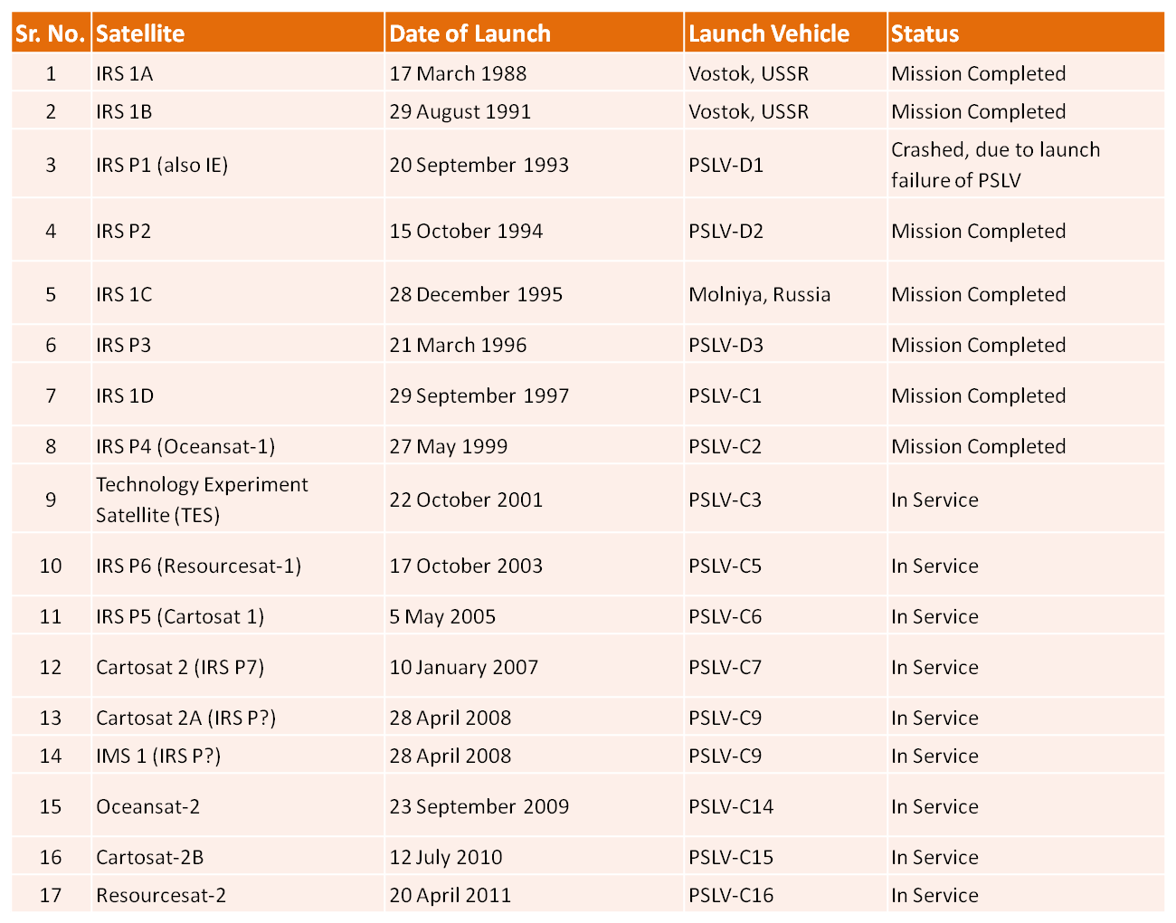
List of Indian Remote Sensing Satellites (With date of launch, Name of the launch vehicle and their current status) – As on Oct 2011;

Source : NRSA, ISRO


Hi Shailesh.Ur post was nice.It helped me alot.Thanks.
Thanks Shabeena! Do subscribe to the GreenCleanGuide.com for receiving updated information.